Coming up: tents, treks, sheep, snacks, useful maps and resources, life hacks and pro-tips, some of England’s most remote areas, and everything you need to know about hiking St. Cuthbert’s Way.
One of my favorite long-distance wanders, St. Cuthbert’s Way is an ancient pilgrimage route, meandering through some of the most significant sites from the life of the 7th-century Anglo-Saxon saint St. Cuthbert.
The route ends on a strange, sometimes-inaccessible island, it runs through remote hills, working farms, and little towns and villages, and it starts near a big ruined abbey. Best of all, it’s a little-known route; good for following a waymarked trail without hundreds of other hikers.
But how many days does the route take? Where does it go? Is it easy to follow? Are there any dangers? What’s this I’ve heard about snakes and legless lizards? And why are we asking you so many hypothetical questions?
Coming up, all that and more: here’s everything you need to know about St. Cuthbert’s Way. Let’s go!
St. Cuthbert’s Way: An Overview
Back in medieval times, there was a big region called ‘Northumbria’… which is now made up of northern England and southern Scotland. When Northumbria was at its largest, its southern border was where Hull and Leeds now are. Its northern border was close to Edinburgh.
Anyway, St. Cuthbert was a saint of the Northumbrian church. A famous preacher, he helped to spread Christianity throughout this region. He also (allegedly) performed a few miracles and spent some of his life as a hermit.
This trail is built to honor him, and visits some of the most significant places from his life. They include:
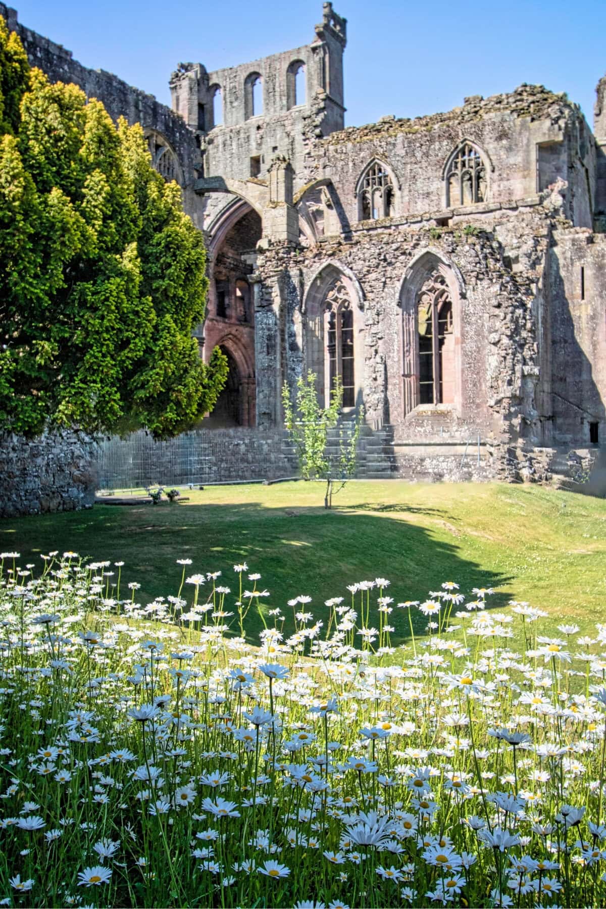
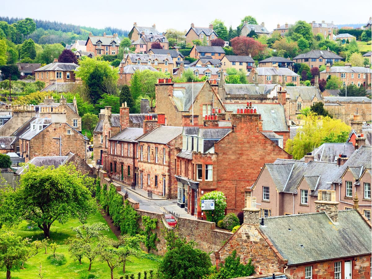
- Melrose Abbey: the start point of the walk, St. Cuthbert was born close to the town of Melrose, and trained at this abbey.
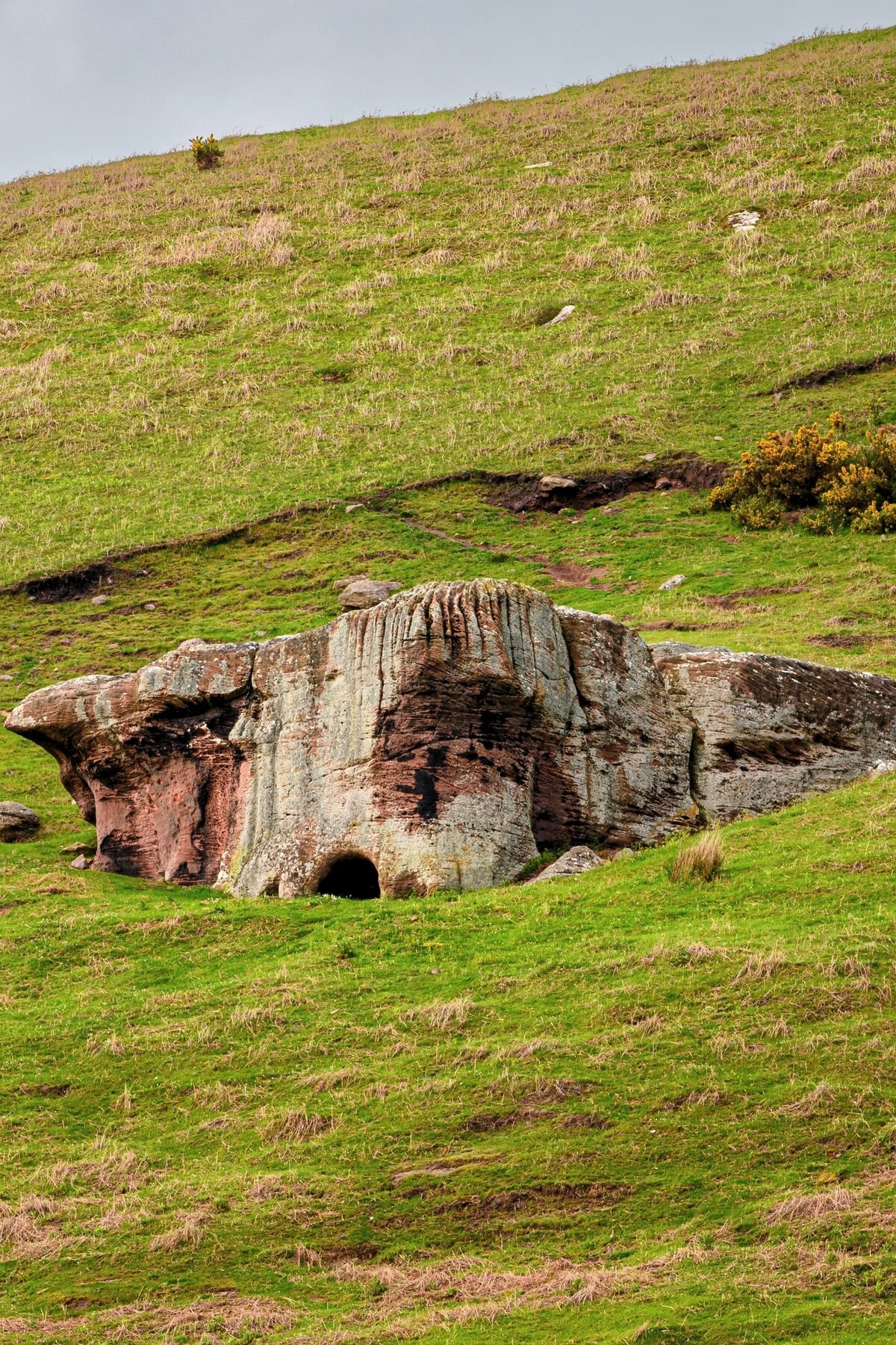
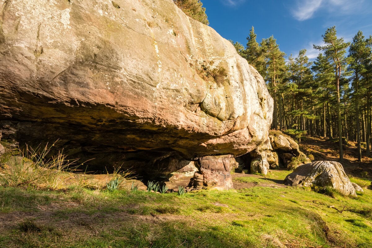
- St. Cuthbert’s Cave: In 875 AD, Lindisfarne monks were scared of the prospect of another Viking invasion. So they fled the island, taking their most important belongings—including the body of St. Cuthbert. This cave (according to some sources) is one of the places where they hid.
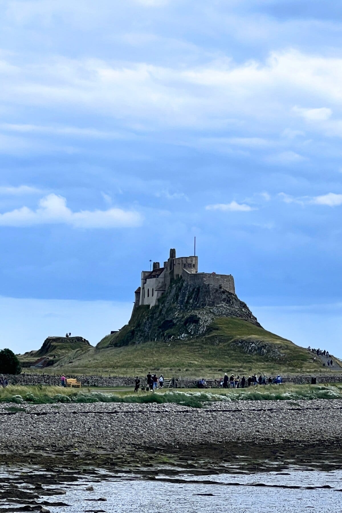
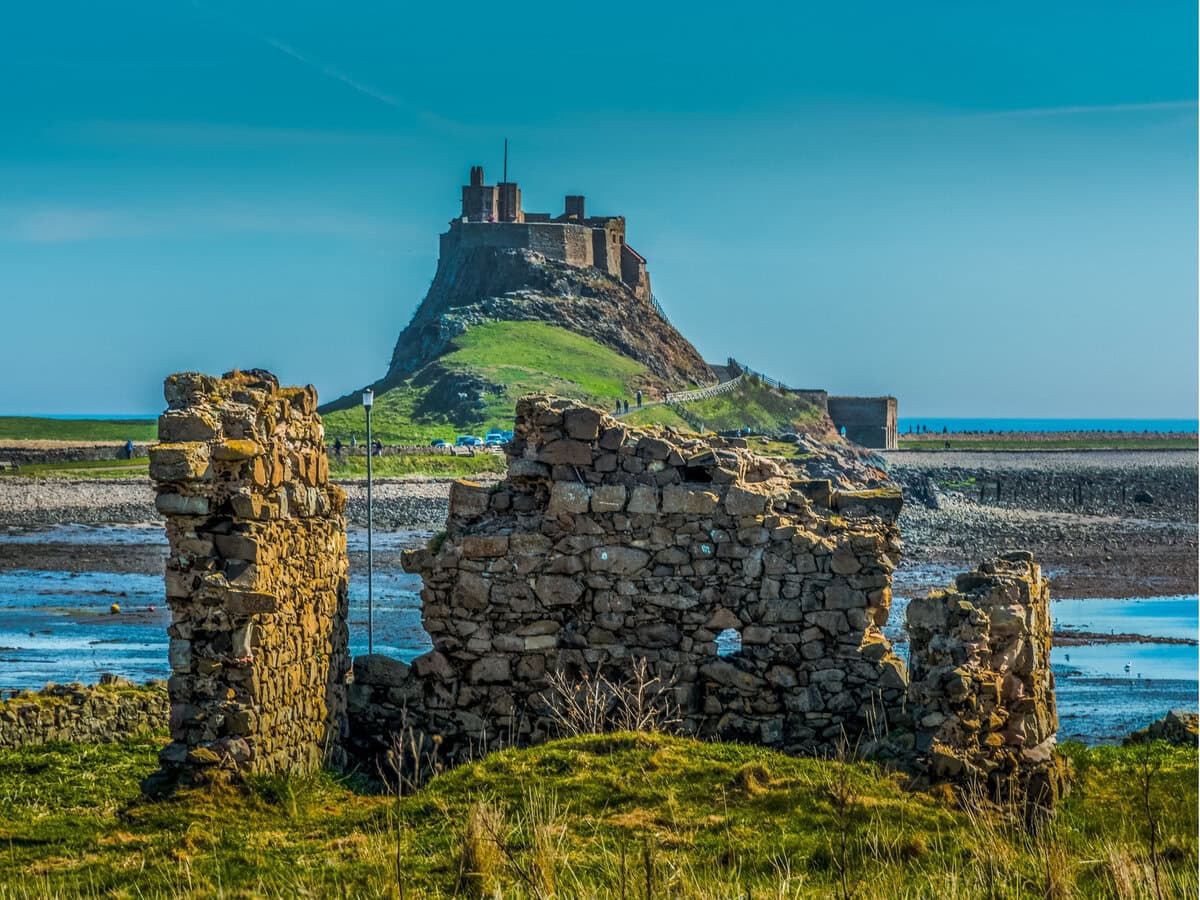
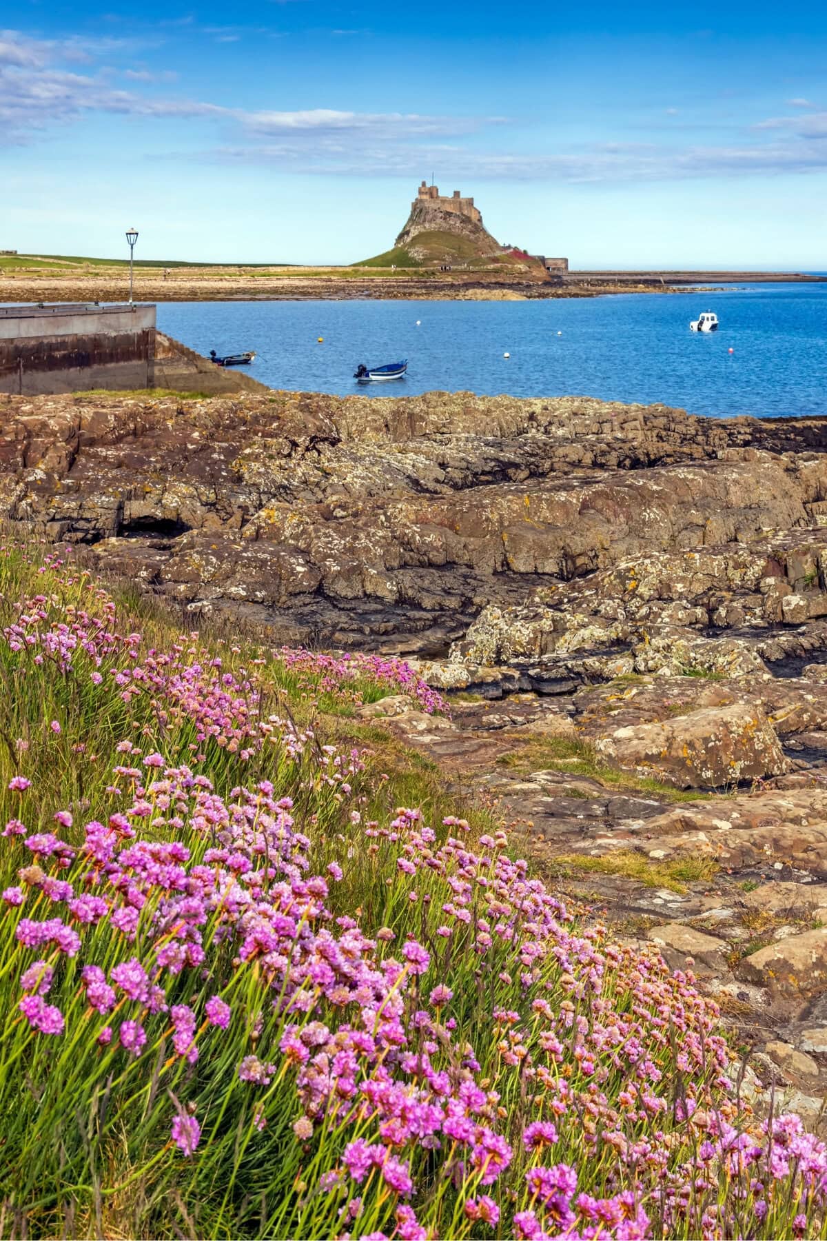
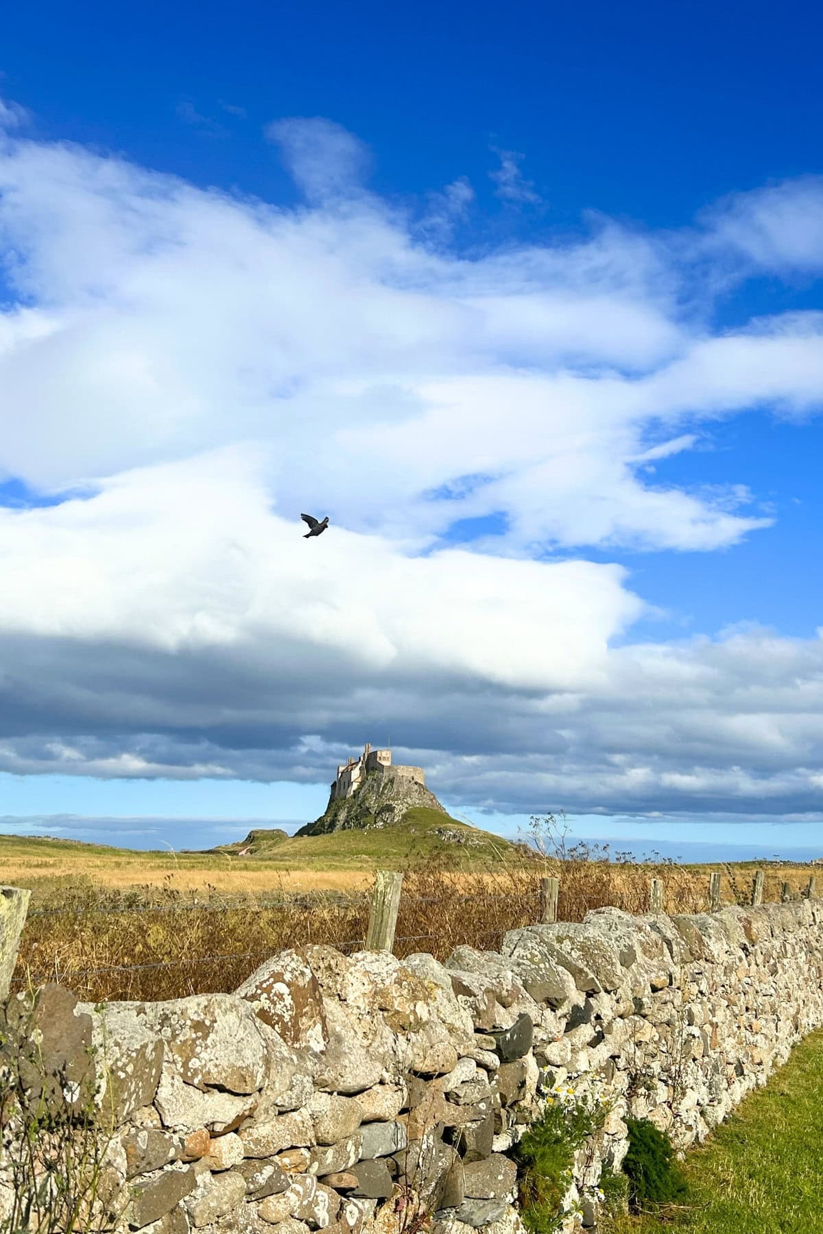
- Holy Island: also known as ‘Lindisfarne,’ this island was one of early Christianity’s most sacred sites… and St. Cuthbert did lots of work here.
Route Overview – or Why You Should Hike St. Cuthbert’s Way
I’ve hiked lots of long-distance trails, in many different countries.
St. Cuthbert’s Way is one of my favorites, for a few different reasons.
Including:
- It ends on Holy Island: this strange unique island has lots of history, and a small secluded population (of 160 people). It’s only accessible at certain times of day (more on that later), and was once a hugely sacred place. A genuinely world-class way to finish a walk.
- Very few people know about it: so you won’t see many other hikers, and you’ll feel like you’re on a ‘real’ adventure.
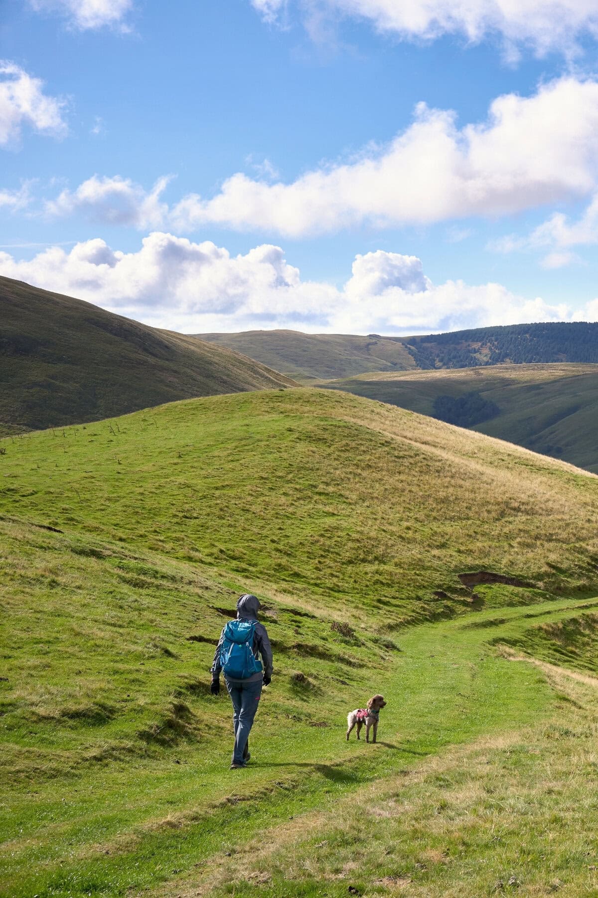
- Around 15-20% of the hike takes walkers across the boggy, barren, and mysterious Cheviots (one of England’s least-explored mountain ranges): and not *just* the Cheviots, but some of the Cheviots’ most remote and quiet sections.
- Although it’s a big adventure, you can get it done in four days. Many of the UK’s better-known long-distance hikes are a little (or a lot!) longer.
- This is one of the friendliest parts of England, so you’ll meet lots of smiley locals. That means in accommodations, on the trail, and as you’re wandering through towns and villages.
In short, it’s a big old blend of history, nature, and adventure.
It’s best-suited to:
- People interested in religious history
- People who want quiet trails with few other hikers
- Those who want to hit a multi-day hike, but without investing too much time
- Moderately fit hikers. You don’t need to be super fit for this hike, but you need to be capable of a reasonable challenge. If you’ve ever done any multi-day hiking, or even relatively challenging one-day hikes, you’ll be fine with St. Cuthbert’s Way.
Most people tackle the trek in 4 or 5 days. If you choose four days, you’ll need to be careful with tide timings, and whether that matches up with how fit you are.
Because, here’s the thing: the final part of the walk is the hike to Holy Island, which is only accessible when the causeway (the path leading to the island) isn’t covered by the sea.
On the day I wrote this guide, for example (in December 2024, for those who are curious), the safe-crossing times are from 07:25 until 13:40, and again from 19:35 until 02:10. But because the sun will have set by 19:35, you only really have until 13:40 to cross. And because the final day of the 4-day version of the hike is around 19 miles (31 km) that means you’d need to have walked all 19 miles (31 km) by 13:40.
So, plan accordingly. More on that later.
Here’s the best resource for checking safe-crossing times. It’s from Northumberland County Council, the region’s governing body.
St. Cuthbert’s Way: Practical info
- Starting point: Melrose, southern Scotland.
- Ending point: Holy Island (Lindisfarne), northeastern England.
- Total distance: 62 miles (100 km)
- Difficulty level: easy to moderately easy (by the standards of multi-day hikes)
- Suggested duration: preferably 4 days, but often 5 days
- Total elevation gain: 2,075 meters (6,808 feet)
- Highest point of the trail: Wideopen Hill, halfway through the walk, at 368 meters (1,207 feet)
St. Cuthbert’s Way: Our Day-by-Day Breakdown
Day 1: Melrose to Ancrum
- Total distance today: 15 miles (24 km)
- Total elevation gain today: 428 meters (1,404 feet)
The official start of the walk is Melrose Abbey, a grand old ruin where St. Cuthbert trained and worked.
You walk through some of the town, before a steep start to the day. Almost immediately, you get one of the most challenging parts of the hike—the ascent up Eildon Hills. Here, you climb around 200 meters (656 feet), around half of the daily total in one short steep section.

But it’s worth the challenge, with great views both before and behind you.
Other highlights of the day include lots of farmland, partially following the Tweed River, a potential detour to Dryburgh Abbey (which adds a total of 2 miles (3.2 km) to your trip), and the cute village of St. Boswells (where you can stop at the cute and cozy Mainstreet Trading Company for coffee and cake).
Day 2: Ancrum to Kirk Yetholm
- Total distance today: 17.5 miles (28 km)
- Total elevation gain today: 643 meters (2,110 feet)
Today’s big highlights is Wideopen Hill, the highest point of the entire hike (which sits at 386 meters/1,207 feet). It serves up big views of Bowmont Water valley, and you reach this peak around 1 hour before the end of the day.
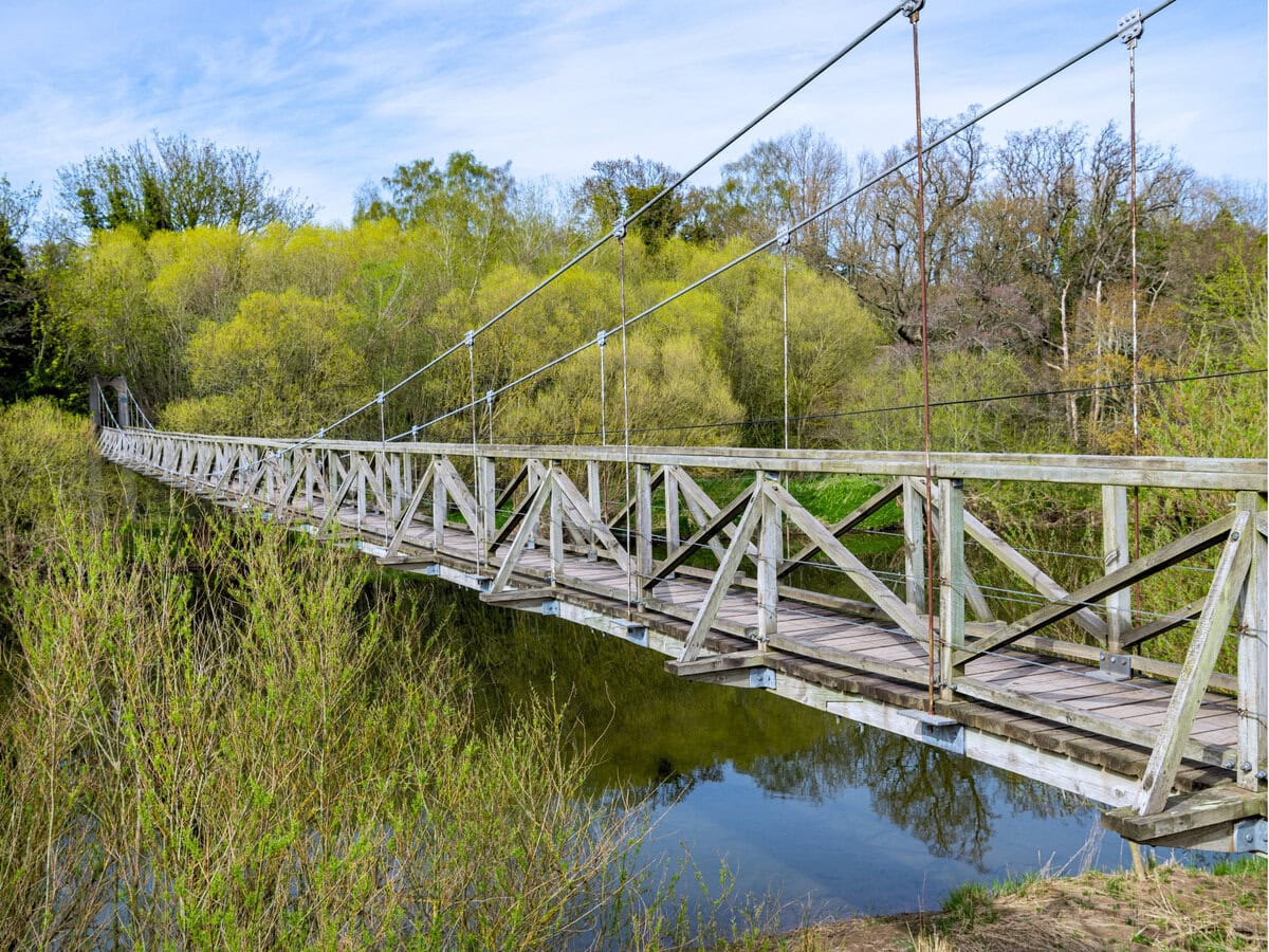
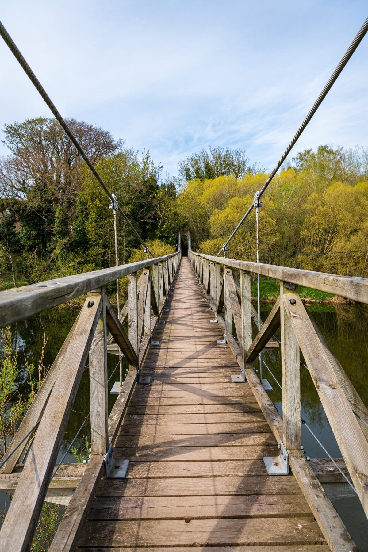
Before then, other high points include Monteviot suspension bridge, views of Waterloo Monument (built to commemorate the Battle of Waterloo), many farms and woods, the cute village of Morebattle, and the ridge walk leading to Wideopen Hill.
If it’s a sunny day when you reach Kirk Yetholm, head to the Border Hotel (which is also a pub), and sit in the sun with some food and drinks. It’s a great way to finish your second day, and celebrate reaching the halfway point.
Day 3: Kirk Yetholm to Wooler
- Total distance today: 13 miles (21 km)
- Total elevation gain today: 615 meters (2,018 feet)
This is easily the best day of the walk—for the vast majority of day 3, you’re wandering through the remote, boggy, and barren Cheviots.
You start the day by leaving Kirk Yetholm and arriving on the England-Scotland border. There’s no official border crossing (obviously), just a small wooden waymarker reading both ‘welcome to England’ and ‘welcome to Scotland.’
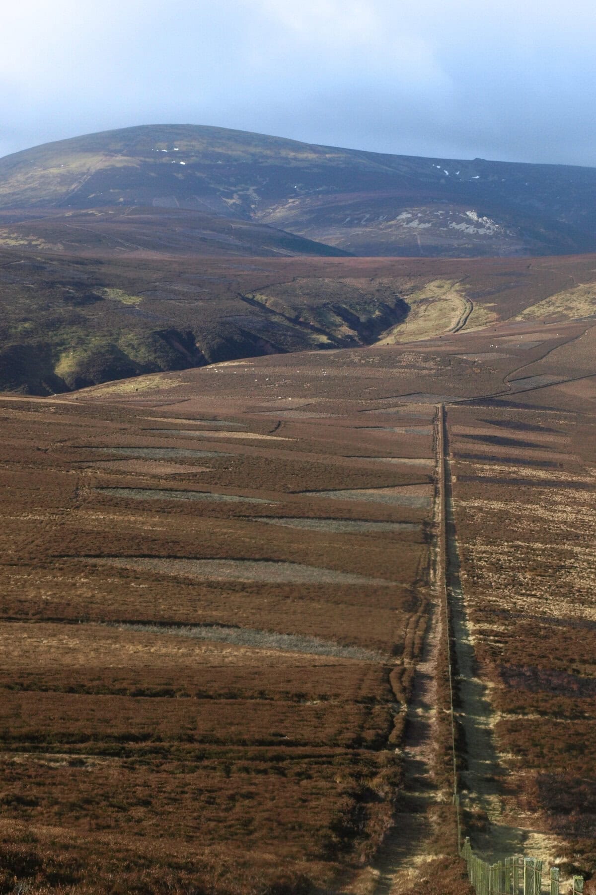
Although today seems like it would be the hilliest day (cos it’s in the Cheviots), there are very few steep sections. For the most part, the landscape undulates undramatically, with lots of manageable ups and downs. Expect heather, moors, hills, hidden valleys, many sheep, and the little Hethpool Linn waterfall. One of the best days of hiking I’ve ever had.
Wooler itself is a lovely cozy town, in the foothills of the Cheviots. Expect pubs, cafes, homely hotels, stone cottages, and the excellent ice creams of Doddington Dairy Milk Bar.
Day 4 (or days 4 and 5): Wooler to Holy Island
- Total distance of this section: 18 miles (29 km)
- Total elevation gain of this section: 389 meters (1,276 feet)
Some people tackle this stretch in one day. Some people stay in Fenwick, which is around 75% of the way between Wooler and Holy Island.
Today is the least-pretty day, and the least-challenging day. So I definitely recommend completing it in one stretch instead of two.
But, as we mentioned earlier, the tide times might not be in your favor (especially if you don’t want to wake up early). So check those tide times before you make a decision.
Highlights today include St. Cuthbert’s Cave, the views just after St. Cuthbert’s Cave, lots of cows, crossing the causeway onto Holy Island, and exploring the island itself.
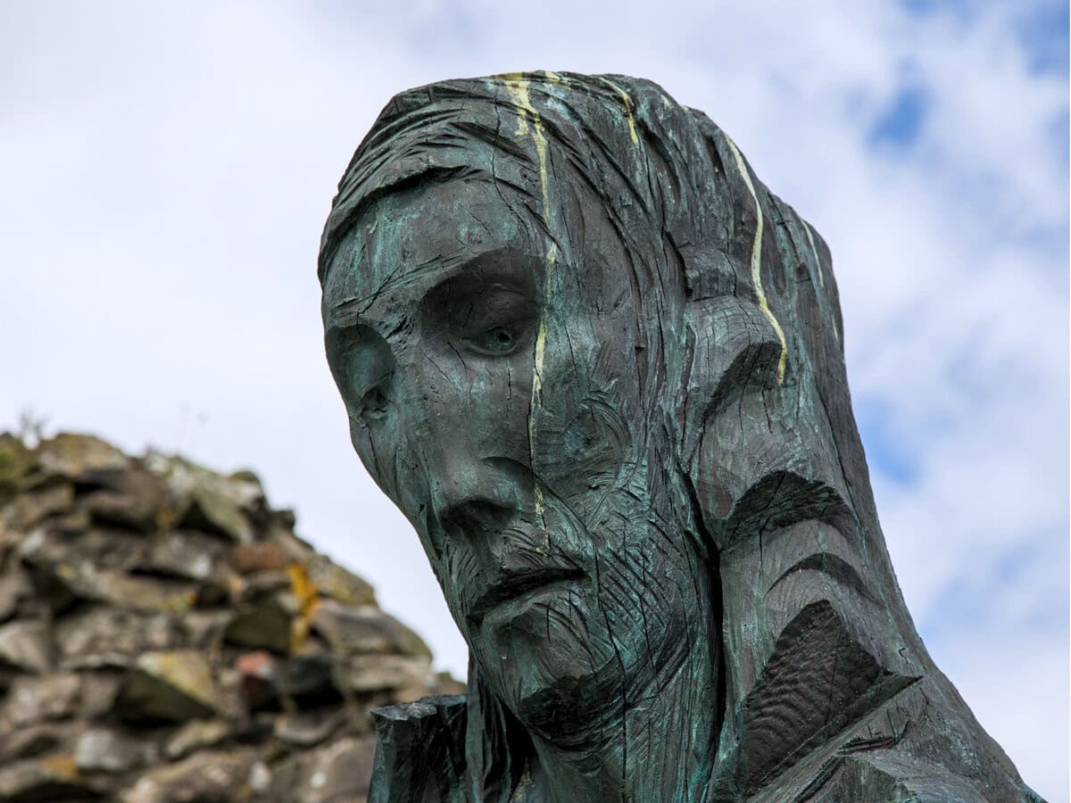
The official endpoint of the hike is (appropriately) Lindisfarne Abbey, which is accompanied by a statue of the big man himself.
St. Cuthbert’s Way: Planning Your Trek
The best time to go
The best time by far to hike St. Cuthbert’s Way is late spring, or anytime in summer (so that’s May, June, July, or August).
During this period, you get better weather (well, a better chance of good weather, cos there’s no guarantee in this part of the world), along with longer days.
August can be tricky, cos it coincides with the British school holidays—so you get lots of vacationers, fully-booked accommodations, and lots of busy bustle.
So, if I could choose any month, it would be June. The towns and villages (and trail) will be quiet, average temperatures will be at 15°C (59°F), and you get around 17 hours of sunlight per day.
You don’t want to tackle this hike in winter. The days are short, the weather can be miserable, and lots of accommodations (not that there are many of them!) will be closed.
Transportation to Melrose
To reach Melrose, your best option is typically the direct 67 bus from Berwick, which takes around 1 hour and 45 minutes. It leaves from Berwick train station, which has direct connections to places like Edinburgh, Newcastle, and even London.
Transportation from Holy Island
When most people leave Holy Island, they take the 477 bus from the island to Berwick, before then hopping on a train from Berwick. The timetable changes regularly, it’s a victim of the tides, it doesn’t run every day, and the schedule is especially limited in winter.
As of now, there is no bus from Holy Island to Newcastle.
It’s also possible to book a local taxi, which any pub, cafe, restaurant or accommodation can do for you. A one-way trip to Berwick will cost you around £35 (well, as of 2024).
Navigational tools
First thing: the trail is very well-marked, and you should be able to survive without any apps or guidebooks.
I didn’t use any of them, but I am familiar with the area (I was born and raised in this part of the world), and I can be a bit cavalier. So if you want to stay safe, the two apps I recommend are:
- Maps.me: great for offline access, Maps.me has a basic interface and very few features. But it’s easy to read and use, and hiking trails are clearly marked. The best option for non-natives who want an app they can use with no data.
- Komoot: my favorite navigation app, Komoot is a little more detailed than Maps.me. The interface is prettier, and the maps are more detailed, but there’s not a huge amount of difference between the two.
A guidebook can be good for keeping you on-track—and for practical information, help with where to eat and sleep, and information about history, people, places, and St. Cuthbert himself. This is the best of them all—it has photographs, a great map, and lots of useful context and facts. Highly recommended!
St. Cuthbert’s Way: Packing and Preparation
Gear checklist
- If you want to look after your knees, take some hiking poles: these Trekology ones are affordable and reliable.
- Waterproof clothes: in the UK, you get lots of rain (even when rain isn’t forecast). So, yep, you should wear a good waterproof coat, along with some waterproof boots. But waterproof trousers are also a good idea. Here are some affordable ones that zip off into shorts in case the weather’s good.
- Mainly, you’ll wear hiking boots: but hiking boots on asphalt can damage your knees… and during St. Cuthbert’s Way, there’s a fair amount of asphalt action. So: also take some lightweight running shoes for the asphalt sections. Trust me on this one. Bonus point: these lightweight running shoes are nice for wearing in pubs and cafes etc when you’ve finished the day’s hiking.
- Blisters have the power to ruin a multi-day hike (yep, I’ve been there): so these Compeed blister plasters can be a lifesaver.
- Merino Wool socks are magical: they keep your feet warm, they wick the sweat away, they avoid the need for doubling-up on socks in cold weather, and they can even help to stop blisters.
- You might want to take a Kindle or a book: although there are plenty of pubs and restaurants to keep you entertained, there’s not much else to ‘do’ on this hike. So if you’re hiking solo (or hate the person you’re hiking with), you’ll want some entertainment.
- If you’re familiar with midges, I’m sorry. If you’re not, I’m sorry in advance. These horrible irritating little flies aren’t too common in this part of the UK, but you might still find some. Get some of this midge spray if you’ll be hiking in spring or summer. For more, here’s everything you need to know about midges.

If you’ll be camping, you’ll want a good windproof waterproof compact easy-to-carry tent. Our favorite is the MIER Lanshan Ultralight, which is super durable and portable. And it’ll stand up to any weather you’ll encounter (this is Britain, not the arctic). Setup is a little more time-consuming than ideal, but you should get it up within ten minutes.
Oh, and if you’re camping, you should also take a ground mat, and a good warm lightweight sleeping bag.
For more outside sleeping advice, here’s our guide to the best tents for wild camping in Scotland. All of those tents will work for this hike.
Clothing for unpredictable weather
St. Cuthbert’s Way isn’t the most precarious trek on the planet.
But the stretch through the Cheviots is very barren and remote, and weather in this part of the world is unpredictable (and often wet and windy).
So, you should always pack cold-weather clothes and wet-weather clothes (even if the weather forecast doesn’t say it’ll be cold or wet).
Provisions: food, water, and hydration tips
- On day three, you won’t find anywhere to refill your water: so I recommend carrying a big high-quality refillable bottle (of at least 1 liter). Buy a metal one, cos plastic ones always smash (this has happened to me about 4 times, woops). Here’s a good affordable option.
- You’ll never go an entire day without finding somewhere to buy snacks: and with the exception of day three, you’ll always find more than one place to buy them. So, yep, take some morsels and munchies with you, but don’t pack as if you’re gonna be spending endless days in the wilderness.
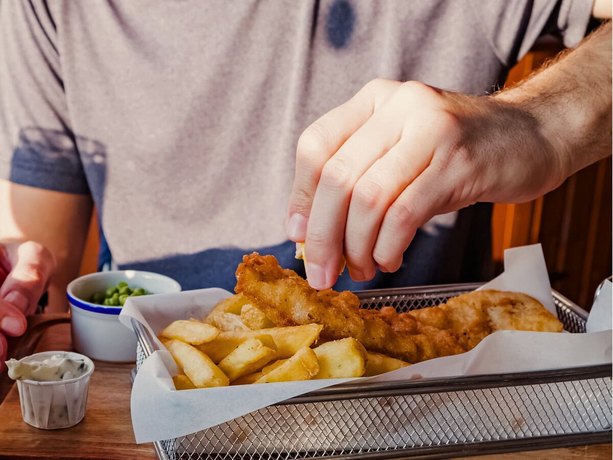
- You’ll eat basically all of your meals in pubs: in rural England, most restaurants are inside pubs. And they usually sell the same type of stuff (pies, curries, fish and chips, scampi). Don’t expect it to be healthy, but expect it to be tasty.
- If you’ve never done any multi-day hiking, you might not know which snacks you should carry. So, what I recommend is: dried fruit, fresh fruit, nuts, seeds, and flapjacks. The key is finding stuff that is healthy, calorie-dense, and lightweight.
- If you run out of water, you won’t find drinkable streams like you might in many other countries. Instead, you might find farms or water fountains with water. Alternatively, you can stop and ask any cafe/pub/hotel/guesthouse to fill your water for you. They’ll be happy to do it, even if you’re not buying anything from them.
St. Cuthbert’s Way: Accommodations Along the Trail
Along the hike, you’ll find hotels, B&Bs, hostels, and campsites.
If you want to stay indoors (ie, not camping), the best options per night are:
- Night 0 (Melrose, where you might stay if you arrive late): The Townhouse Hotel is fancy and modern, while family-managed Station Hotel and Restaurant is a little more old-school. Both include good breakfasts.
- Night 1 (Jedburgh): you’ll find a huge number of accommodations here (well, relatively speaking). Meadhon Guesthouse is very central and very popular, with a pretty stone aesthetic, while Auld Cross Keys Inn is an excellent option for those seeking an old-school pub with retro vibes.
- Night 2 (Kirk Yetholm): The Border Hotel is one of my favorite rural pubs, with great food and drinks. When I did this hike, they had no beds left (so book now!). Your next-best option is the Plough Hotel. Or, if you’re on a budget, head to Kirk Yetholm Hostel.
- Night 3 (Wooler): Wooler Hostel & Shepherd Huts is very lovable and charming. If you’re instead looking for something a bit more fancy, I recommend either The Black Bull Inn (a 17th-century old-school pub), or the cute and unique Humble Hut.
- Night 4 (Holy Island): The Ship Inn is super central, and one of the island’s most iconic pubs and hotels, while The Manor House Hotel is an ideal option if you want to end your trek with a bit of a fancy flourish. You should book in advance for this entire trek… but you should DEFINITELY book in advance for Holy Island. This place is a hugely popular tourist destination.
Although this isn’t a busy trek, there aren’t many accommodations. So in warmer months (April through to August), you should always book in advance—and as far in advance as you can.
That said, you usually don’t need to book far in advance for campsites. Some of the best camping options along the trail are Old Mill Caravan Site at West Kyloe Farm, the Jedburgh Camping and Caravanning Club site, and Melrose Gibson Park Caravan and Motorhome Club Campsite. If you want an ‘official’ campsite for every night of the trail, you’ll struggle—but wild camping is completely legal in Scotland, and it’s well-tolerated in rural northern England, assuming you’re respectful and quiet, and not trespassing.
Trail Etiquette and Safety Tips
- Leave no trace: obviously, you’re probably not an idiot. But just in case you are an idiot and need reminding, please don’t leave any trash on the trail. In this part of the world, people are very respectful of nature, and don’t leave anything behind. So: leave every part of the trail exactly how you found it.
- Although the trail is well-waymarked, don’t get complacent: if you’re distracted and not paying attention, it would be pretty easy to end up off-trail. So pay attention, look out for signs every few minutes, and consider using the apps and guidebook we recommended.
- Respect local people: don’t make huge amounts of noise, don’t stay up super late drinking and singing, don’t be noisy if you’re staying in guesthouses, don’t trespass onto anyone’s property.
- Watch out for adders: although they’re rare, and you’ll rarely (or probably never) see any, this part of England is home to venomous adders. Good news though: they don’t like biting people, and the bites are typically only dangerous to the very young, very ill or very old. That said—if you are bitten, get some medical attention.
- Don’t confuse slow worms for adders: much more common than snakes are slow worms. But here’s the confusing part: these slow worms are legless lizards, and they therefore look a lot like snakes. But while adders are green, black, and zig-zagged, slow worms are smaller, thinner, sort-of shiny, and one plain browny-green color.
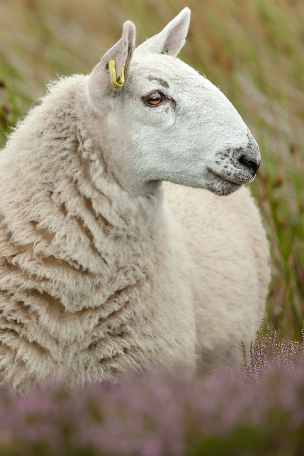
- Respect local wildlife: you might see some interesting animals (like adders, slow worms, birds, rabbits, and sheep). Look at them, but don’t prod them, feed them, or frighten them. Lambs and sheep might (but probably won’t) approach you. If they do, you can pet them, gently.
- You can drink any and all tap water on the hike.
- Most people walk west to east (as we’ve described in this guide), mainly because the entry to Holy Island is a perfect way to end the trip. But you can tackle the trek in both directions—and when I did St. Cuthbert’s Way, I actually hiked east to west. What a hypocrite, I know.
- You’ll probably see lots of cows: and cows can (very very rarely) be dangerous. For the most part, I don’t worry about them unless there are baby cows in the field (or unless there’s a bull). When you encounter cows, don’t make eye contact, move away quickly but calmly, give them space, turn sideways, and don’t make sudden noises. Oh, and when most cows attack people, they’re attacking them because that person has a dog. If you have a dog, keep it very very close, on a leash.
St. Cuthbert’s Way: Connecting and nearby routes
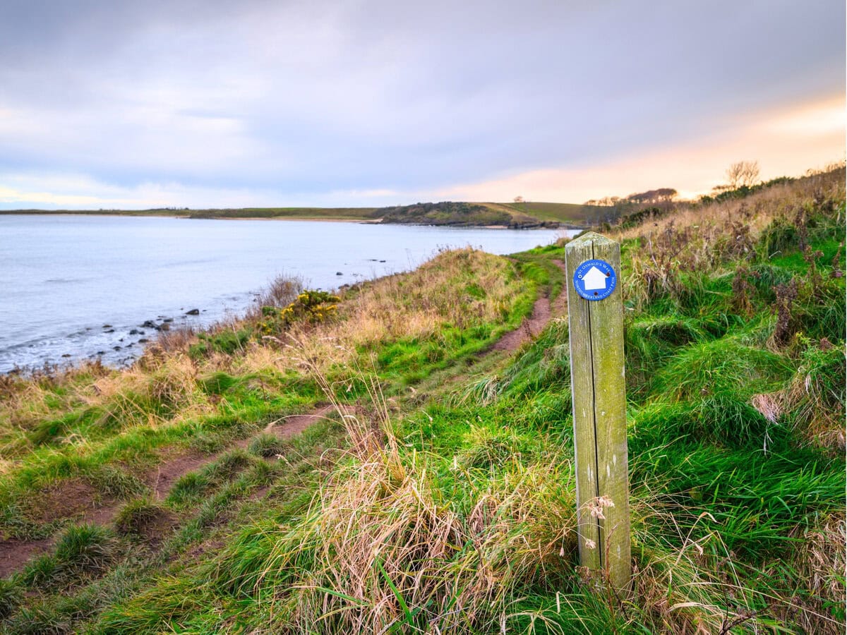
- St. Oswald’s Way: another route named in honor of a saint, and another pilgrimage hike involving Holy Island. A little longer than St. Cuthbert’s, St. Oswald’s Way measures in at 97 miles (156 km), and features Hadrian’s Wall, coastlines, and castles. Until converging close to Holy Island, the two walks (surprisingly) don’t meet each other.
- Hadrian’s Wall: one of the UK’s most iconic hikes, this walk starts in Newcastle and finishes on northern England’s west coast. It follows the route of an old Roman wall, which was built to keep the northern barbarians out of Roman territory. In addition to all the views, you also get lots of Roman ruins and relics.
- The Pennine Way: the UK’s most famous long-distance trail, the Pennine Way starts close to Manchester, and runs through the spine of northern England (finishing, as we’ve already mentioned, just inside the Scottish border). Measuring in at 268 miles (429 km), it’s a massive challenge, and a real adventure—and some parts are very remote.
- Northumberland Coast Path: running all the way along the Northumberland Coast, this route starts in tiny Cresswell and ends in Berwick-upon-Tweed. Measuring 62 miles (100 km), it’s mostly flat and easy… and it’s a great option for beginners who love the seaside. It hugs the coast for around 75% of its length.
- Borders Abbeys Way: more abbeys, more religious history. A circular hike through the Scottish borders, this one measures in at 66.5 miles (107 km), and takes hikers to four ruined abbeys: at Melrose, Dryburgh, Jedburgh, and Kelso. Another great option for people seeking an underrated and lesser-known hike.
St. Cuthbert’s Way: Final Thoughts
So, that’s everything you need to know about St. Cuthbert’s Way!
To sum up, it’s a super-unique trail, it’s one of England’s least-known routes, and you won’t see many other hikers. And because it’s relatively short and relatively easy, it’s a good choice for people who don’t have much time (or much hiking experience).
So, yep: we recommend doing it!
For more walking and wandering in Northumberland and Scotland, hike on over to our guides on:
- The 19 best hikes in and around Edinburgh
- The 17 best hikes in Northumberland
- The 15 best hikes in Scotland
Thanks for reading, thanks for visiting Travelness, and we’ll see you again soon. Keep scrolling down!


